


Garmin Edge 1050 Bundle


Garmin Edge 1050 Bundle
Navigation makes our daily lives easier and the travel experience better. Once you've selected an address, Garmin GPS bike navigation calculates the ideal route in a flash, plus gives you directions to your destination. You no longer need paper maps or to learn complicated itineraries. You can see the route thanks to the easy-to-read 3.5" screen size displayand resolution800 × 480 px. It is also fully touch-sensitive and can be intuitively operated. The navigation system has a battery that guarantees operation for up to 20 hours, which is sufficient even on longer routes. All maps are stored in the 64 GB internal memory.
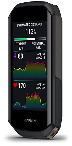
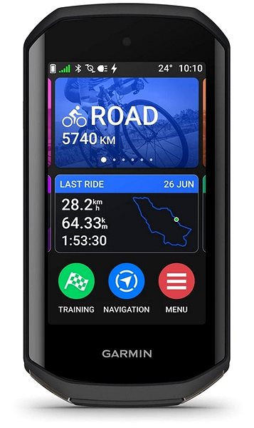
Key Features of the Garmin Edge 1050 Bundle GPS Navigation System
- Garmin Cyclonavigation finds a safe and suitable route for cycling
- Easy-to-read 3.5" display with 800 × 480 px resolution
- Screen with intuitive controls
- Battery will allow operation for up to 20 h
- Internal memory of 64 GB is available to store all maps
- Useful features include maps of the Czech Republic + Europe, can be mounted on the dashboard and coordinates
- Updates to stored maps are made via mobile phone
- Receive up-to-date traffic information via mobile phone
- Package contents include safety strap, cable, holder, sensors and case
- Android and iOS compatibility
- Connects to your device using Bluetooth technology
- The colour of the case is black
Modern features ensure that your journey to your destination is comfortable
Garmin GPS navigation with a range of advanced features brings useful benefits. Displays the current driving time and current speed, based on this tracked data, it can better plan the route and estimate the arrival time more accurately. The clear display gives you information on total time and distance travelled so far. The device is able to calculate and record your average speed. With an integrated altimeter, you'll be able to monitor the elevation you've climbed along the route. The built-in thermometer gives you an overview of the ambient air temperature.
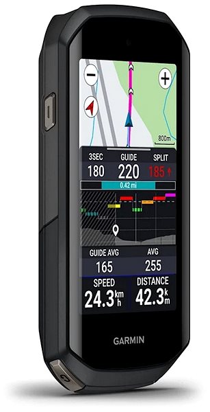
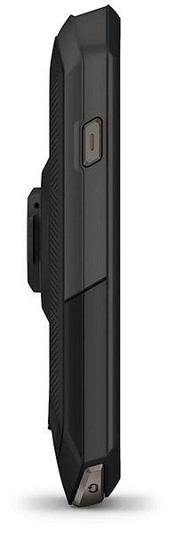
Always find your target
Simply enter your destination address and Garmin will show you the appropriate route, so you can avoid wandering and unnecessary stress. The navigation equipment includes a package of pre-installed maps of the Czech Republic and Europe. Updates to stored maps work via mobile phone, ensuring access to up-to-date maps and all travel information. Receiving current traffic information is done via mobile phone. GPS navigation is supported by Android and iOS.
GPS navigation is the ideal tool for effective sports
You'll benefit from a route record, which you can then view and evaluate again at home. Your heart rate is monitored by a heart rate sensor. If you exercise to lose weight, you'll be pleased to know that this device tracks calories burned. If you want to boost your performance, track your improvements and set new goals, a training diary will help you. This product also tracks cadence, or pedaling speed, which ensures that the intensity of each ride is monitored.
GPS navigation dimensions:
118.5 × 60.2 × 16.3 mm (h × w × d)
Weight:
161 g
Specifications
Navigation type
Hardware and Software
Sensors and detectors
Battery life and memory
Equipment and features
Cyclofunction
Maps
Languages
Dimensions
Weight
Color and finish
Package contents

Garmin Würzburg GmbH, Leightonstraße 7, 97074 Würzburg, Německo, www.garmin.com, [email protected]
Specifications can be changed without notice. Images are for illustrative purposes only.